New York City Mayor Eric Adams and city planners have started the public review process on a new project called the Atlantic Avenue Mixed-Use Plan, which will add thousands of new homes and street upgrades.
The plan includes the building of 4,600 new homes, 1,440 of which will be affordable for low-income earners. The project is estimated to create 2,800 jobs in Crown Heights and Bedford-Stuyvesant, according to a press release.
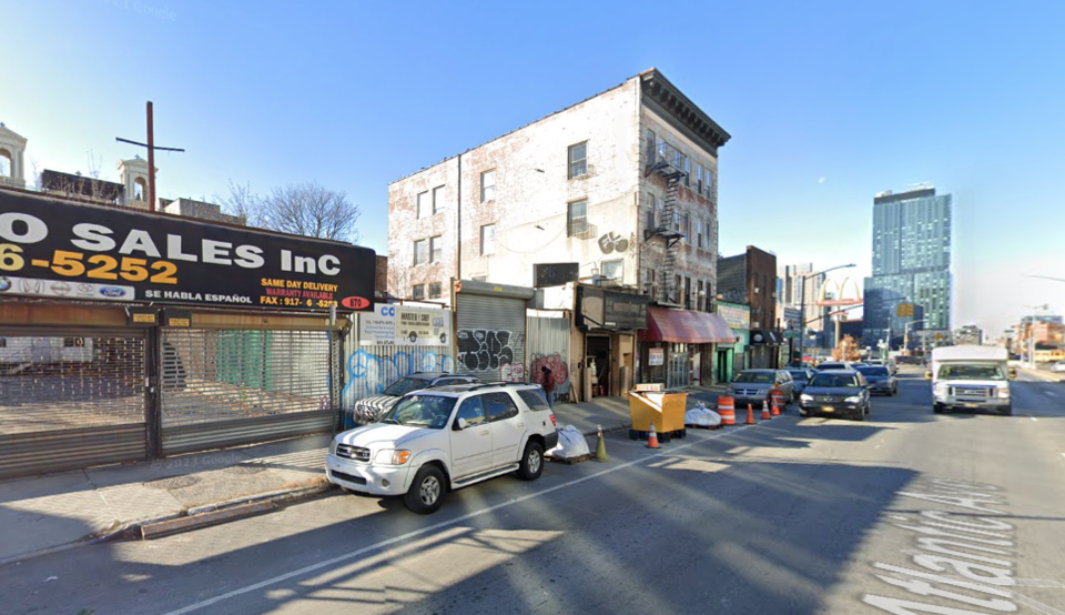
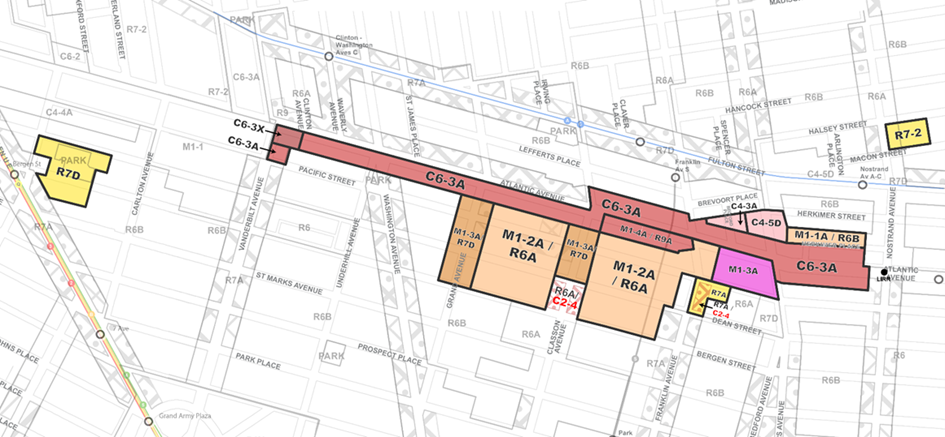
The Atlantic Avenue Mixed-Use Plan focuses on a section of Atlantic Avenue and neighboring streets between Vanderbilt Avenue and Nostrand Avenue. Since the 1960s, this area has been zoned for one-to-two industrial buildings and storage, despite its proximity to a major commercial area and transit hub.
The plan calls for high-density housing — with permanently income-restricted and rent-stabilized affordable units through Mandatory Inclusionary Housing — and a mix of commercial ground floor spaces on Atlantic Avenue. Through this change, the area will transform from a corridor of vacant lots, self-storage facilities, and auto-shops to a mix of homes, as well as commercial and manufacturing businesses.
On neighboring avenues and streets, the plan would encourage moderately-sized mixed-use buildings with income-restricted affordable housing and job-generating uses.
The plan will see the construction of over 380 income-restricted affordable homes at several sites in Crown Heights and Prospect Heights including 542 Dean Street, 516 Bergen Street, and 1134-1142 Pacific Street, benefiting the elderly and the formerly homeless, the press release said.
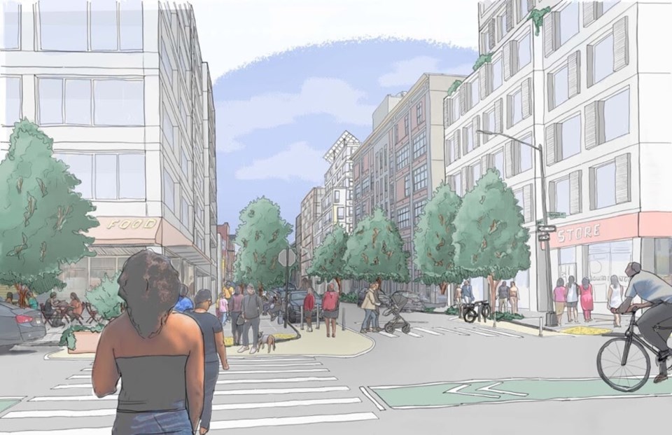
The plan also includes street safety initiatives through the installation of plants, bike parking and daylight visibility at intersections. This work will include painted “neckdowns,” which are raised curb extensions that narrow the travel lane at intersections or midblock locations, to expand curbside protections; daylighting to improve visibility at intersections; planters; and bike corrals along medians throughout the neighborhood; as well as a new bike lane on Bedford Avenue.
To better serve pedestrians, new developments in the plan’s geography would be required to set their buildings further away from the street to create up to a 20-foot-wide sidewalk — an increase from the 8-to-15-foot-wide sidewalks that exist today.
The plan also includes $24.2 million for St. Andrew’s Playground, including adding a new, synthetic turf multi-use field with a running track, upgraded basketball and handball courts, renovated playground spaces, a remodeled public restroom, new seating, shade trees, plantings, and other green infrastructure.
The city also wants to improve Lowry Triangle, near Atlantic Avenue and Washington Avenue, to help community members better enjoy and use the space. The plan would also create a zoning incentive for additional publicly accessible open space.
The project will complete the design phase in 2025 and anticipate construction to start in 2026.
“Safer streets, more affordable housing, community spaces for our older adults and young people, jobs for communities in need — this proposal is the result of multiple agencies, City Hall, and everyday New Yorkers coming together to transform and build the neighborhoods of tomorrow, today," the mayor said. "As it goes through the public review process, I encourage all New Yorkers to make their voices heard, listen to the facts, and embrace the endless possibilities within this proposal. The future is in their hands and all it requires them to say is ‘yes’ to opportunity."
Following this announcement, the roughly seven-month Uniform Land Use Review Procedure will commence, which includes recommendations from Community Boards 3 and 8 and Borough President Reynoso. This will be followed by hearings and binding votes at the City Planning Commission and then a City Council vote.


